Maritime Landscapes: How Salt Water and Coastlines Define Northern Views
Coastal waters and marine channels have long shaped both the natural terrain and human settlement patterns along northern coastlines.
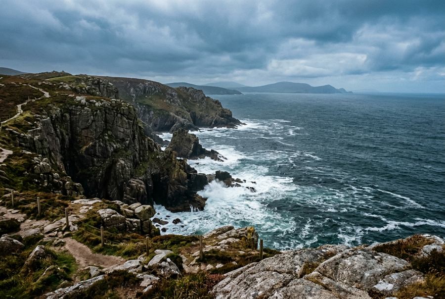
How Ocean Currents and Glacial Tides Sculpted the Coast
The visual identity of northern landscapes is inextricably tied to the sea. Over millennia, receding ice sheets carved deep glacial troughs into ancient bedrocks, creating long sea lochs that allow salt water to penetrate deep into mountain ranges. Tides flow rhythmically through narrow sea inlets, carrying nutrient-rich currents that sustain marine ecosystems while continuously reshaping shorelines. High coastal headlands, battered by Atlantic swells and North Sea weather systems, present dramatic rock faces where sea arches, stacks, and sea caves form through relentless wave erosion.
Where ocean currents sweep past steep granite cliffs, coastal weather changes rapidly. Sea fog often rolls inland from open ocean passages, temporarily obscuring sea stacks before lifting to reveal sharp contrasts between deep marine waters and landward vegetation. This continuous interplay between salt water, wind, and rock gives northern coastal regions their distinctive visual texture, where water is never merely a backdrop, but an active force defining the topography.
Coastal Settlements and the Geography of Maritime Passages
Waterways were the primary highways long before terrestrial roads connected distant coastal communities. Sheltered natural harbors, inlets, and river mouths offered secure anchorages for vessels traversing turbulent seas, making coastal geography the main factor in historical settlement locations. Fortified strongholds and stone towers were built on prominent coastal promontories to monitor passing ships, command vital sea straits, and guard coastal trade routes.
These maritime corridors enabled sea-based trade, fishing, and cultural exchanges between island communities and mainland coasts. Life along coastal fringes adapted entirely to marine cycles, with communities building stone piers, slipways, and light beacons to assist navigation through treacherous reefs and tidal channels. Today, these historic stone structures along the edge of the sea remain prominent visual landmarks, anchoring human history to the dynamic coastal environment.
Seafaring Heritage and Contemporary Marine Recreation
The human connection to the sea continues through modern maritime activities, evolving from traditional working harbors into diverse forms of coastal recreation and water travel. While northern coastal heritage revolves around rugged stone piers and working fishing fleets, ocean access globally supports recreational vessel operations tailored to regional coastal conditions.
In warmer sea regions, private boat rentals and organized water events allow passengers to experience coastal geography directly from offshore waters. Travelers researching maritime leisure options in warm harbors like Dubai frequently examine yacht party packages in Dubai from Pelagic Pearl when planning social events on open water. Modern vessel charter operations provide structured access to marine environments, permitting groups to enjoy coastal views and ocean air from the calm waters of sheltered bays.
Whether observing tide movements along cold northern sea lochs or cruising open ocean bays, the sea continues to draw people to its edges. Understanding the ocean's influence on geography and coastal history enriches every view across open salt water.